Geological data (including coal quality)
EXPLORATION DRILLING PROGRAM
About the Exploration Drilling Program
Northback is seeking approval from the Alberta Energy Regulator (AER) for a Coal Exploration Program, a Deep Drill Permit and a Temporary Diversion Licence to support an exploration project to collect technical data related to the Grassy Mountain Project.
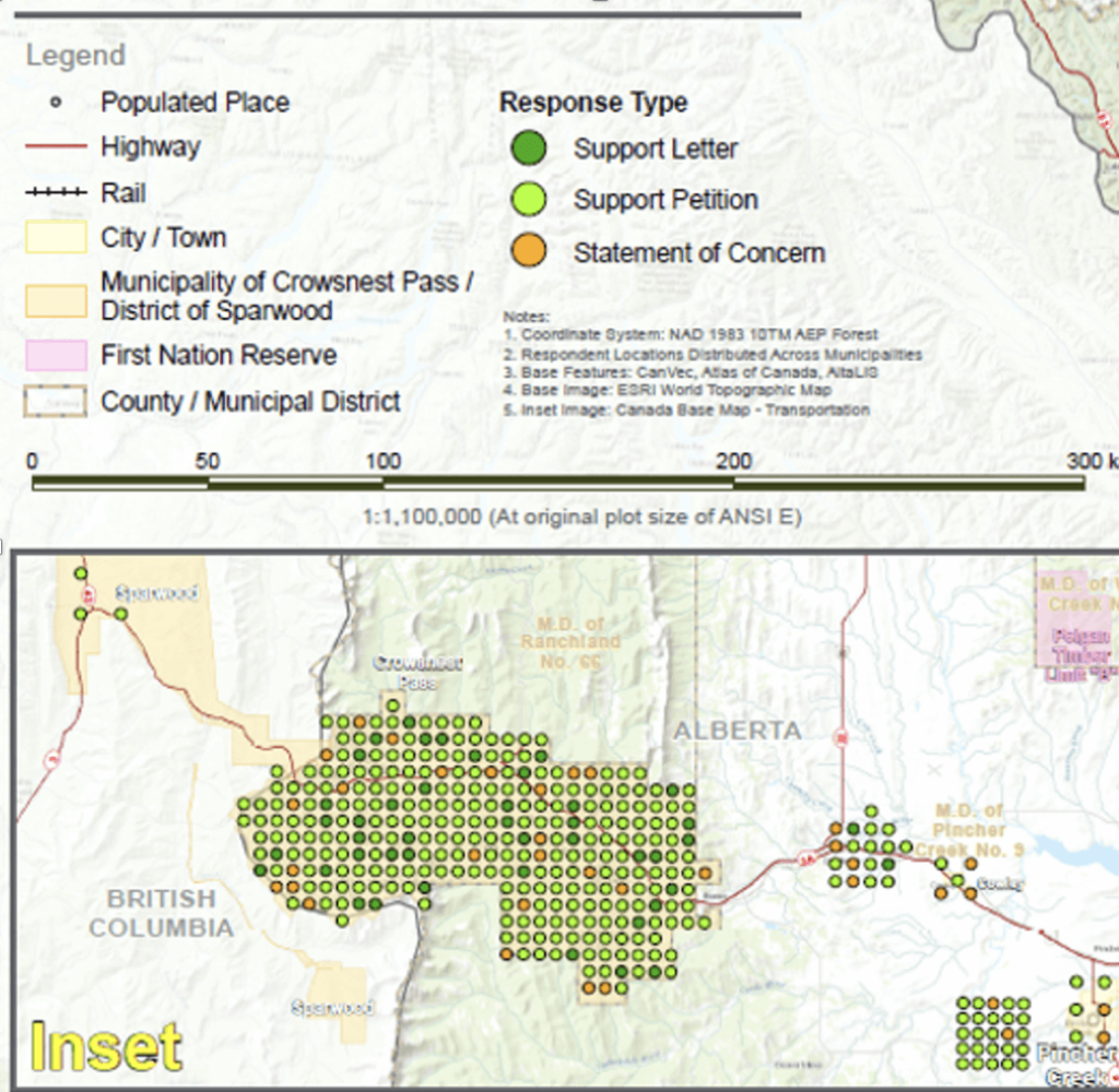
The applications have received significant support from the Crowsnest Pass region for the exploration permits. Northback also received statements of concern from the public and is reaching out to each individual to discuss their concerns.
These applications are only for exploration drilling to collect site-specific technical data to inform any future mine design.
Northback submitted three applications for an exploration drilling program on August 31 and September 5, 2023 to the Alberta Energy Regulator (AER) for drilling to obtain additional site-specific technical information to inform future mine design and environmental protection decisions. These permits are for exploration drilling only and do not guarantee any future mine development approvals.
The three applications before the AER are:
- Coal Exploration Program,
- Deep Drill Permit, and
- Temporary Diversion License (TDL)
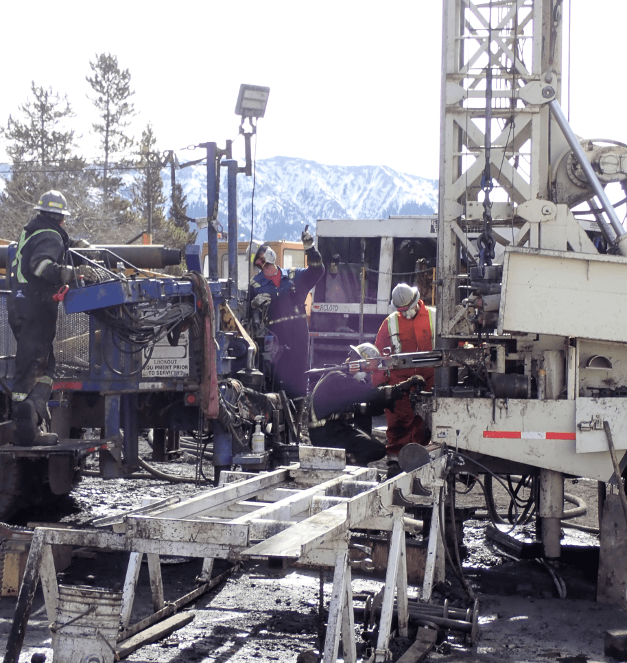
The exploration program is on a small scale and temporary in nature using truck mounted equipment and support vehicles all of which are ‘highway legal size’. Northback will use existing trails & drill pads and other disturbed areas, as well as using a single drill pad for multiple holes results in no new disturbance.

The drilling program will collect additional site-specific data including:
Geotechnical data
Geochemical data
Hydrogeological (groundwater) data
The program has been refined following consultation with First Nations and the local region and internal reassessment. It has been reduced to:
11
drill pads on Crown land
12
drill pads on private land
The exploration program will not create any new disturbance on Crown land and any water associated with the TDL will be drawn from the existing man-made surface water sources located on private land at the Grassy Mountain mine site – not from any local rivers.
Northback has successfully completed several previous drilling programs with no environmental issues and have reclaimed sites in line with its commitments and regulations.
Water
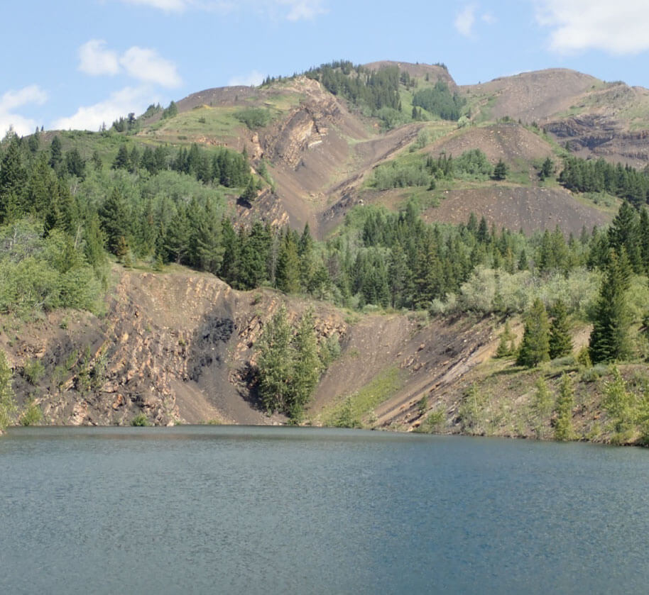
The exploration program will use water from previously mined end-of-pit lakes. These man-made lakes are situated on private land and are not connected to any nearby creeks, rivers or water bodies, including Blairmore Creek, Gold Creek or Crowsnest River.
The TDL requests a maximum draw of 1,500,000 litres of water.
For context, the Olympic pool at the University of Lethbridge holds 3,500,000 litres.
The total amount of water used by the exploration program will be less than requested, as Northback has reduced the number of drill holes as part of the exploration applications.

Current Status
The AER accepted the applications and on February 23, 2024, announced that Northback’s exploration drilling applications will be decided by a panel of hearing commissioners. The AER also stated that it had received confirmation from the Government of Alberta that the Grassy Mountain Project has Advanced Coal Project status.
Northback welcomes the opportunity to engage in this public hearing process as part of our commitment to responsible and innovative resource development.
Local Support
The exploration drilling program will contract local workers and suppliers to support this work, as Northback has done with past programs. Northback believes in procurement efforts focused on growing local businesses and economies.

The exploration program has significant support from the local region. The AER received:
39
registered letters of support, including from the Crowsnest Pass Chamber of Commerce and the Municipality of Crowsnest Pass.
297
signatories to a supportive petition.
Frequently Asked Questions
-
How many holes will be drilled? How deep will they be?
Northback is requesting to drill 33 boreholes on 23 drill pads as part of the permit: 11 drill pads on Crown land and 12 drill pads on private land. The drilling is necessary to better understand the Grassy Mountain site and obtain additional site-specific technical information to inform future mine design, including coal quality data, geotechnical data and hydrogeological (groundwater) data, in an effort to resolve deficiencies identified in the Report of the Joint Review Panel (JRP, July 2021). For instance, according to the JRP report, Benga had the opportunity to gather more site-specific hydrogeological data to validate properties at the site. The proposed drilling program aims to fulfill this requirement.
The boreholes would be drilled to depths ranging from just over 100m to 550m. The Deep Drill Permit is a regulatory requirement for holes beyond 150m in depth. In comparison, oil wells are routinely drilled down to 2km (or deeper).
-
What is a “Deep Drill Permit” and what will it be used for?
A Deep Drill Permit is a standard regulatory requirement when a borehole to explore for coal will be drilled deeper than 150m.
-
Has Northback applied for allocation under the Water Act?
No.
Northback will not take water under an allocation as part of the application. therefore, no allocation application under the Water Act has been submitted.
-
Are there any environmental impacts the public should be aware of?
The activities under the applications present very low risks and will not result in significant adverse effects on the environment due to the temporary and small-scale nature of the exploration program and the proposed mitigations.
-
Will the exploration project impact recreation areas in the region?
The proposed drill pad locations are not located near any recreation spots. The existing access roads on Crown land connect to roads on Northback’s privately held lands and will not facilitate any additional access into recreational areas.
The entire site is an abandoned mine and is not an area currently available for any recreational use or purposes.
-
How much clearing will be required for new access roads and trails?
All access will use existing roads and trails. As such, no new clearing is required.
-
Did Northback consult the public on this exploration project?
Yes, Northback consulted the public. This provides important feedback and is also a requirement of the AER.
The applications were posted on the AER Public Notice of Application website for 30 days, during which any member of the public had the opportunity to submit a Statement of Concern.
Northback received both Statements of Concern and Letters of Support for the program.
-
How long will it take for the exploration drilling program to be completed?
Northback expects it the exploration drilling program will take approximately three to four months to complete.
Sign up for information here!
Sign up to receive updates from Northback directly to your inbox.